


Trail reroutes and closures
Find out more about where you can walk during the Fire Danger Season and permanent and temporary reroutes and closures on the Heysen Trail.
Heysen Trail closures during the Fire Danger Season
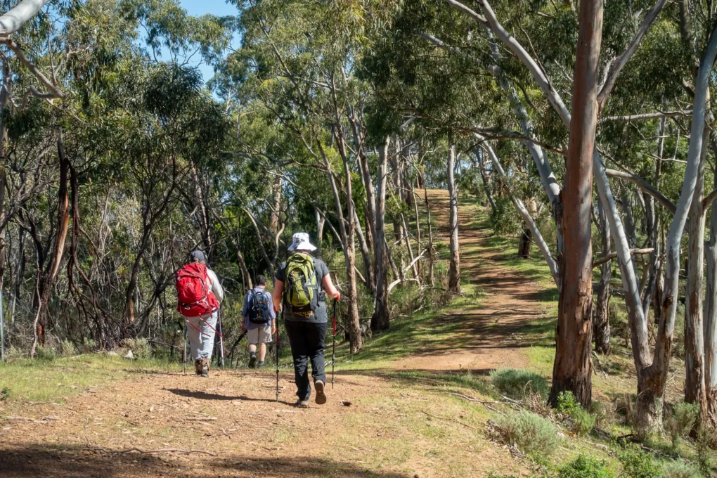
Due to our hot, dry summers, much of the 1,200 km Heysen Trail is closed during the Fire Danger Season. This is usually from November to April each year, however the South Australian Country Fire Service (CFS) may extend the Fire Danger Season. This means it’s important to check the dates of the Fire Danger Season on your Heysen Trail printed maps are correct for the current fire season before your hike.
Trail Status:
Closed
The Heysen Trail is currently closed for the Fire Danger Season. Some National Parks along the Trail remain open all year but always check alerts before you walk.
Fire danger season 2025 – 2026
The CFS has announced the following Fire Danger Season dates for 2025/2026:
- Mount Lofty Ranges: 15 November 2024 to 30 April 2025
- Adelaide Metropolitan: 15 November 2024 to 30 April 2025
- Mid North: 1 November 2024 to 30 April 2025
- Flinders: 15 October 2024 to 15 April 2025
Fire Ban Districts
You should know which Fire Ban District you are hiking through. This is because the Fire Danger Season may be different in some Fire Ban Districts. The Heysen Trail passes through:
- The Mount Lofty Ranges Fire Ban District from the start of the Trail at Cape Jervis to Tanunda
- The Mid North Fire Ban District from Tanunda to Wirrabara Forest
- The Flinders Fire Ban District from Wirrabara Forest to the end of the Trail in the Parachilna Gorge
- The Adelaide Metro Fire Ban District within the Mount Lofty Ranges District – fire danger dates for the Adelaide Metro District may be different to the dates for the rest of the Mount Lofty Ranges District
You can view the Fire Ban Districts on our Interactive Map.
Where to walk during the Fire Ban Season
Walking trails in national parks, ForestrySA forests and SA Water reservoirs are not automatically closed during the Fire Danger Season, however they are closed on days when the fire danger risk is high.
Closures may be different for different parts of the Heysen Trail and may also depend on the extent of the fire danger, so you should always check for Trail closure advice before you hike.
Heysen Trail and ForestrySA huts and campsites are closed during the Fire Danger Season. Camping may be possible in national parks but always check:
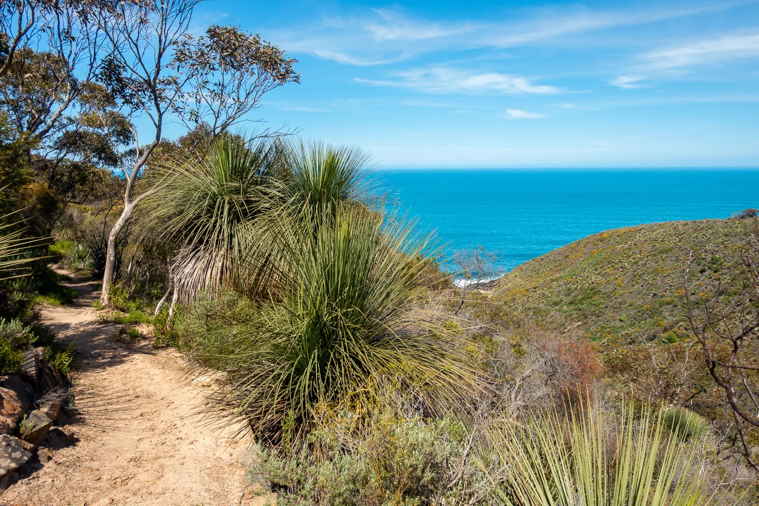
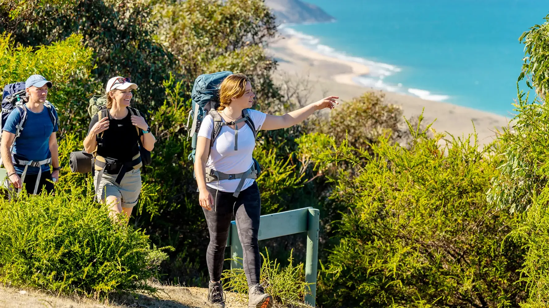
The Wild South Coast Way
The Wild South Coast Way (WSCW) between Cape Jervis and Victor Harbor does not automatically close for the Fire Danger Season. You can hike and camp on the WSCW all year round, except on days declared as Catastrophic Fire Danger. Some parts of the WSCW may also be closed on days of Extreme Fire Danger. You can find the current fire danger rating by checking the CFS Fire Ban District map.
Visit the CFS website, download the Alert SA smartphone app, or phone the CFS Bushfire Information Hotline on 1300 362 361.
Trail reroutes
The 1,200 km Heysen Trail passes through national parks, state forests and privately owned land. From time to time it is necessary to make permanent or temporary changes to the route due to logging in forests, trail maintenance, requests from landholders or to protect our native vegetation. Sometimes these changes may need to be made at short notice. It’s important to follow reroutes as it may be dangerous if you walk in some areas, such as where there are logging operations underway.
Keep up to date with alerts and conditions along the Heysen Trail by looking up your intended path using our Walk Selector. If you’re using official Heysen Trail mapsheets, you can also find out more about permanent Trail reroutes that have been made since each mapsheet was printed.
Temporary Trail closures
Temporary closures are needed for many reasons, including pest and feral animal control. Much of the Trail is closed during the Fire Danger Season.
Listed below are current and upcoming planned temporary Trail closures. Closures due to forestry operations have not been included as ForestrySA organises temporary reroutes which are well signposted. Logging is extremely dangerous and penalties apply where there is unauthorised entry to logging areas.
Everyone’s ongoing access to the Heysen Trail depends upon continued co-operation with private landholders and support from Parks SA, ForestrySA and SA Water, so it’s very important that you don’t try to use closed parts of the Trail.
Find out more about Trail closures in national parks, forestry areas and reservoirs.
Deep Creek National Park (including the section of the Wild South Coast Way on the Heysen Trail within the park) will be closed from 12pm (noon) Sunday 17 May until 12pm (noon) Friday 22 May 2026 for public safety during a pest control program.
To ensure public safety is maintained the park will be closed to all members of the public and no entry and no camping will be permitted for the duration of the operation.
For more information, visit the National Parks and Wildlife Service website or call on (08) 8598 0263. (Entry created 20/1/2026)
Please be advised that Section 15 of the Heysen Trail, specifically the segment between Union Bridge and Tippett Road in Cudlee Creek, is now closed. This closure is effective as of 5pm on Friday the 8th of August 2025 and will remain in place indefinitely.
The Department for Environment and Water (DEW) has been unable to secure access to this section of trail and a safe detour has not yet been established. As this area is private land, hikers will not be permitted to enter and will need to use Gorge Road and Tippett Road through this section to rejoin the existing trail. Please take care walking on these roads.
We understand this may impact your plans and appreciate your understanding. DEW is actively working with the Friends of the Heysen Trail and other stakeholders to find a safe and sustainable solution. We will provide an update as soon as a resolution is found. (Entry created 8/8/2025)
For the purpose of undertaking a feral animal control program, public access will be temporarily prohibited at the Mount Brown Conservation Park from 6am Saturday, 17th October until 2pm Friday, 23rd October 2026.
For more information about the control program or park closure, please contact National Parks and Wildlife Service on (08) 8841 3400. (Entry created 21/3/2026)
For the purpose of undertaking a feral animal control program, public access will be temporarily prohibited at The Dutchman s Stern Conservation Park from 6am Saturday, 17th October until 2pm Friday, 23rd October 2026.
For more information about the control program or park closure, please contact National Parks and Wildlife Service on (08) 8841 3400. (Entry created 21/3/2026)
The Australian Wildlife Conservancy conducts regular programs each year to control feral animals in the Buckaringa Sanctuary.
They are generally held around the same time each year. When details are announced this entry will be updated.
Closure of the sanctuary means these sections of the Heysen Trail cannot be used.
To bypass the closure south-bound walkers should leave the trail just after the Buckaringa North campsite to follow the Buckaringa Scenic Drive south to join the Arden Vale Road … and to rejoin the trail via Warren Gorge.
The first closures for the 2026 year will be from the evening of Wednesday 20th May to the evening Sunday 24th May inclusive.
Other closures are planned for short periods in July and October but the dates are not yet fixed. (Entry updated 20/3/2026)
Heysen Trail mapsheet reroutes
If you are using an official Heysen Trail mapsheet, please check the reroute information below to see if any changes affect your map edition.
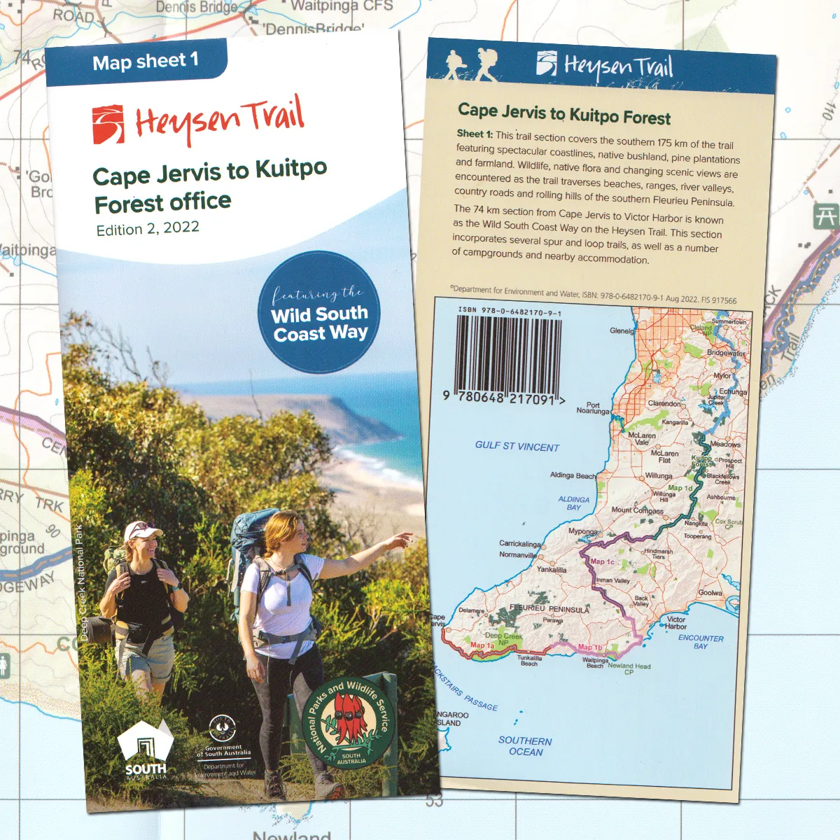
Mapsheet 1: Cape Jervis to Kuitpo Forest (Sept 2014)
Mapsheet 1: Cape Jervis to Kuitpo Forest inc the Wild South Coast Way (Edition 2, 2022)
Mapsheet 2: Kuitpo Forest to Tanunda (Sept 2014)
Mapsheet 3: Tanunda to Burra (May 2015)
Mapsheet 4: Burra to Spalding (May 2015)
Mapsheet 5, Spalding to Wirrabara Forest (August 2015)
Mapsheet 6, Wirrabara Forest to Dutchmans Stern Conservation Park (August 2015)
Mapsheet 7, Dutchmans Stern Conservation Park to Mernmerna Creek (August 2015)
No reroutes
Mapsheet 7, Dutchmans Stern Conservation Park to Mernmerna Creek (Edition 2, 2021)
No reroutes