


Heysen Trail maps
The Heysen Trail has distinctive red markers to help you navigate your path, but it’s still important to carry an official Heysen Trail map on your hike. Learn more about the different types of maps available.

Printed maps of the Heysen Trail
Printed maps are always useful to have on hand during your hike, as they don’t rely on battery life or signal in remote areas. There are several ways to access printed maps of the Trail.
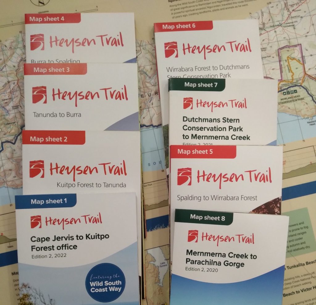
Official Heysen Trail printed map sheets
The Department for Environment and Water (DEW) has released a series of eight printed Heysen Trail mapsheets. Because the Trail needs to be rerouted from time to time, before you set out you should always check our reroutes information to see if your printed mapsheets are up to date.
You can buy these maps from our online store. They’re also available from leading outdoor stores and map shops.
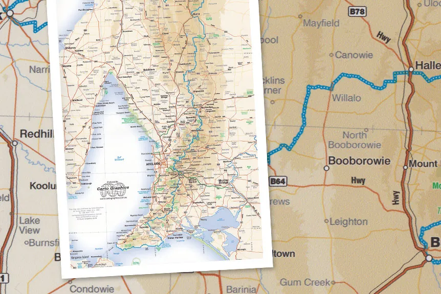
Regional and driving printed maps
In addition to the DEW maps of the Heysen Trail, Carto Graphics has produced a series of four printed regional maps showing the location of the Trail in relation to nearby towns and roads. As much of the Trail is on private property, these maps can help you find the best public access if you’re driving to your start and end points on the Trail. Although the Trail is marked, they don’t include enough detail to be used for navigating as you walk along the Trail.
You can buy Carto Graphics maps from our online store. They’re also available from leading outdoor stores and map shops.
Overview Heysen Trail maps
The Friends of the Heysen Trail have also developed simple overview maps showing different aspects of the Heysen Trail:
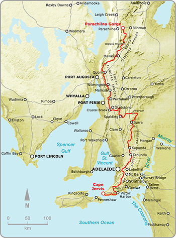
Map 1 showing the Trail with terrain, roads and towns
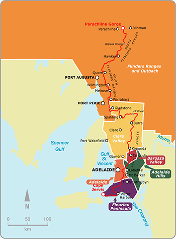
Map 2 showing the tourist regions the Heysen Trail passes through
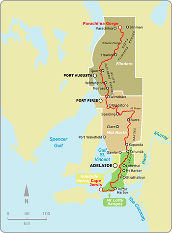
Map 3 showing relevant fire ban districts for the Heysen Trail
Downloadable maps of the Heysen Trail
The Heysen Trail can be viewed with our interactive maps, and you can download GPX files for use on a handheld GPS unit. These are the most accurate maps of the Trail, but we recommend always taking a paper map as well, in case your device fails or is lost.
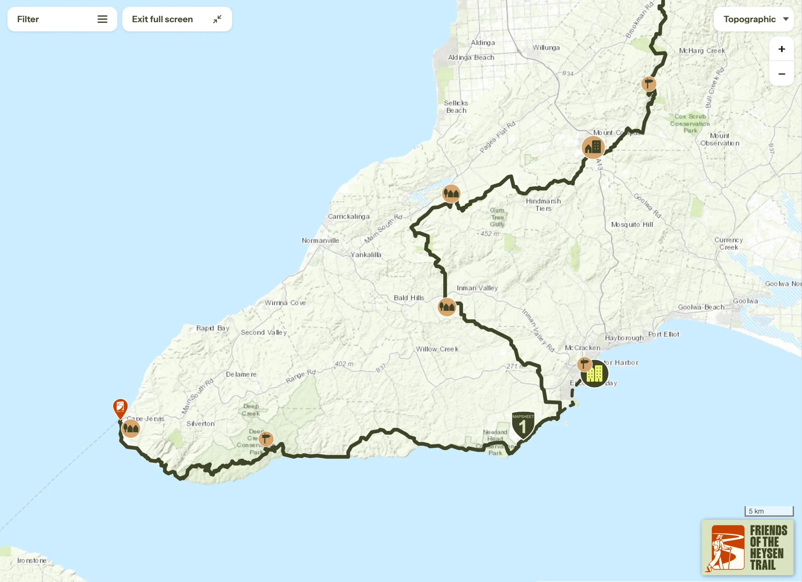
Friends of the Heysen Trail interactive map interface
Our interactive Heysen Trail map has layers showing the route covered by each of the eight official map sheets. You can also add layers for:
- The Friends’ End-to-End guided walk start and finish points
- Fire ban districts
- Tourism regions
- Photos
- Campsites and some accommodation options
The Interactive Map Interface was last updated on 1/4/2026 v5.0.
FarOut Guides Heysen Trail map
You can buy an electronic version of the Heysen Trail map from FarOut (previously Guthook) which can be used on iPhone or Android devices. To access these, download the FarOut Australia New Zealand app from your app store. Within the app, you can search for the Heysen Trail map to purchase and download the map to your device.
GPX file for GPS units
You can download the GPX file to use with handheld GPS units, updated 1/4/2026 v5.0.
The GPX file may be too large for older GPS units. If you’re unsure, check the specifications of your GPS unit. It needs to be able to accept:
- 31 tracks
- Up to 5,000 points per track
- 150 waypoints
If your unit accepts a limit of 20 tracks, the first 11 tracks uploaded will be rewritten. To reduce the number of tracks to 20 you will need to delete or combine some tracks.
View the How-to Guide for Using a GPS Hiking (an article from our Spring 2011 Trailwalker magazine).
Google Earth file
Download the Keyhole Markup Language (KML) file for use in Google Earth, updated 1/4/2026 v5.0.